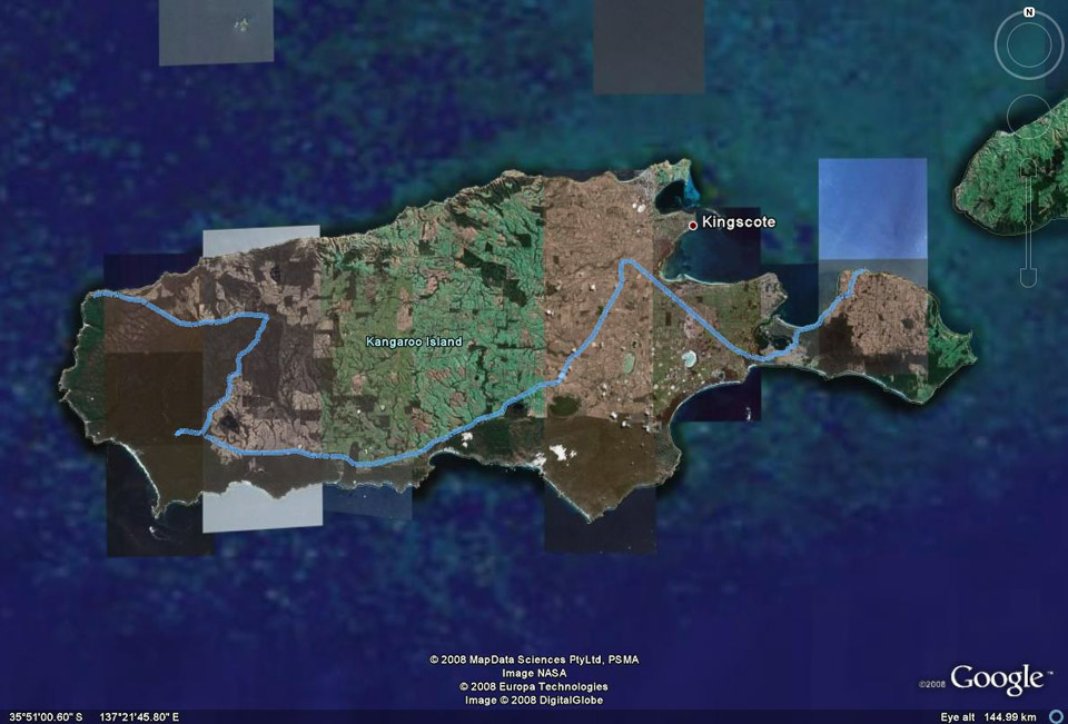
A GPS track of part of our travels on Kangaroo Island superimposed on a Google Earth map. The east (right) end of the track is Penneshaw, the location of the ferry terminal. The west (left) end of the track is Cape Borda.
A GPS track of part of our travels on Kangaroo Island superimposed on a Google Earth map. The east (right) end of the track is Penneshaw, the location of the ferry terminal. The west (left) end of the track is Cape Borda.
